
Printable Parks and Trails Map
One of the most popular recreational activities is walking, and, lucky for us, Central Saanich has many beautiful trails. Click the park names below to see their location on a map.
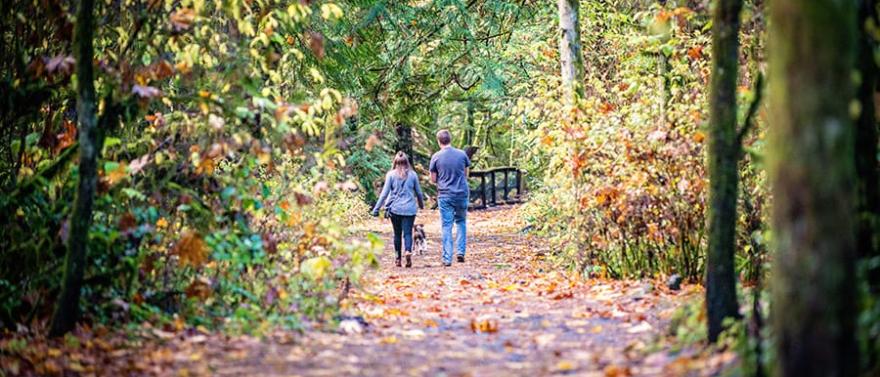
Mount Newton Trail runs along Mt newton Cross Rd and connects West Saanich Road to Wallace Drive. The 1.2 meter-wide gravel trail is suitable for walking, biking and horse-back riding, and is almost entirely separated from the roadway to provide a safety buffer for users from vehicles. The trail meanders through mature trees, including Gerry Oaks and Fir trees, and over a bridge.
Newman Farm Boathouses are located at the eastern most section of Newman Farm, off Lochside Drive. A gravel parking lot opens on to a small field, which is open to the public. At the beach access, stairs were rebuilt, providing access to the foreshore of Ferguson Cove and alowing the public to look into the Newman boathouses.
Hagan Bight is a short walk to a beauitful view point great for wildlife watching.
Oak Haven Park (summit pictured on the right) is a beautiful 10.20-hectare hilltop park is located south of Benvenuto Avenue, between Wallace Drive and West Saanich Road. A 15-minute hike to the summit rewards the visitor with spectacular views of Saanich Inlet, Peninsula farmland, Sidney and James Islands. Late winter/early spring brings an amazing bloom of wild flowers, including: satin flower, camas, shooting star, harvest brodiaea, nodding onion, and red columbine, to name a few. In recent years, the District entered into a conservation covenant with Habitat Acquisiton Trust (HAT) and the Land Conservancy of BC to ensure the long-term protection of this Garry oak ecosystem.
Centennial Park is a 18.42 hectare community park, located in the 7500 block of Wallace Drive, in Saanichton. The park has interconnected walking trails; natural areas and Graham Creek flows along the western boundary.
Butterfield Park is a historical 13-acre property at 8000 Thomson Place, off Mt. Newton Cross Road. This property has a beautiful natural landscape and a small loop trail, but limited parking.
Browns’ Wood Trail begins at 8069 Thomson Place and provides an east-west connection between the Thunderbird Trail (also known as the Gail Wicken’s Trail) and Thomson Place, on the southern slopes of Mount Newton. Winding through one of the most pristine forested landscapes in the community, it is now possible to hike (almost) entirely off-road between Butterfield Park and John Dean Provincial Park. It was Central Saanich residents Dorothy and Bill Brown’s fervent wish that future generations enjoy the exceptional beauty of their land, which led them to donating the public trail corridor through their property.
Gowlland Tod Provincial Park is located on the east side of Saanich Inlet and offers access to three parks: Tod Inlet, Mackenzie Bight and Caleb Pike.The Tod Inlet access is located near Brentwood Bay, off Wallace Drive; Mackenzie Bight access is located off Ross Durrance Road, off Willis Point Road; the Caleb Pike access is on Caleb Pike Road, off Millstream Road near Langford. Gowlland Tod Park can also be accessed by boat via Tod Inlet. This park has more than 25 km of hiking trails, including multi-use trails for hiking, horseback riding and mountain biking.
Lochside Regional Trail follows the roadbed of the old CN Railway, roughly parallel to Highway 17, and passes through Central Saanich, North Saanich, Saanich ,and Sidney and all the way to Victoria. Much of the Central Saanich portion of the trails are through open farmland, and it has various points of interest, including a family of pigs, a model airplane field, a dog training facility, active farm areas, and a farm market. You can walk, cycle, run, or even ride a horse through the rural sections.